QGIS (formerly known as Quantum GIS) is a free, opensource and very advanced GIS program. It can be used to view geographic data, as well as register, modify and delete data.
The project started in 2002. It has more than 35 developers and an estimated 300.000 users around the world today.
QGIS has tremendously good possibilities, when it comes to:
- Visualisation of geographic data
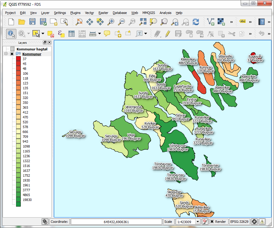
- Dynamic text and symbology, based on the attributes attached to the data (see example below)
- Creation, registration and maintenance of different geographic themes
- Registration in the field, using Android smartphone or pad
- In-depth analysis of data
- Printing with north arrow, legend, scale, remarks
- ...and much much more!
QGIS runs on Windows, Mac, Android (smartphone and pad), Linux and Unix. QGIS reads and writes e.g. ESRI, AutoCAD, MapInfo and MicroStation files.
The example below shows QGIS, with most of the municipalities and their respective inhabitants in the Faroe Islands:

On these pages you will find a tutorial, that explains the basic functionality. It is intended so that you quickly can get started using QGIS.
If you don't know QGIS in advance, we recommend that you follow the order in the index below.
Please click on the topic, that you wish to know more about:
- Who uses QGIS
- Install QGIS 2.0
- User interface
- Add layers
- Layer properties
- Navigation
- Create new layer
- Registration
- Import / export
- Settings
- Project
- Coordinate systems
- Analysis tools
- Printing
- Plugins
