Without data/maps you can not do much, so if you want to work with QGIS, the first thing to do is to add some data into the program.
This can be done at least 2 ways:
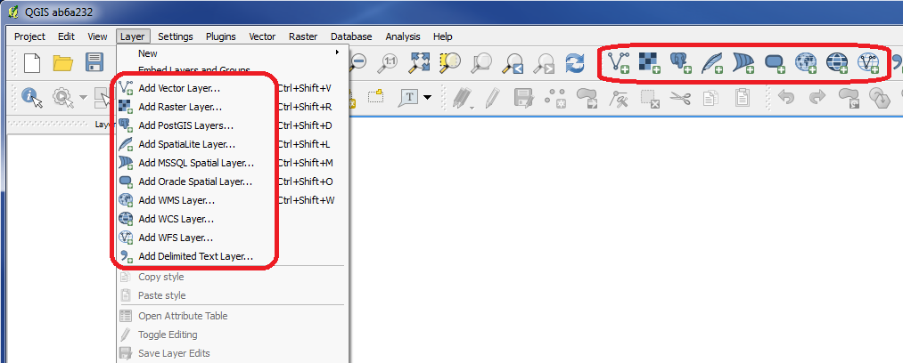
- go to the menu at the top under "Layer"
- use the very blue icons at the top
There are many different types of data to choose between.
 Add Vector Layer
Vector maps can be added here. Read more HERE.
 Add Raster Layer
Raster maps can be added here. Read more HERE.
 Add PostGIS Layer
Maps/data, which are saved in a PostGIS database, can be added with this function. Read more HERE.
 Add SpatiaLite Layer
Maps/data, which are saved in a SpatiaLite database, can be added with this function.
 Add MSSQL Spatial Layer
Maps/data, which are saved in a MSSQL Spatial database, can be added with this function.
 Add Oracle Spatial Layer
Maps/data, which are saved in a Oracle Spatial database, can be added with this function.
 Add WMS Layer
This is the right function if you got a WMS link to the map, you want to use.
 Add WCS Layer
This is the right function if you got a WCS link to the map/data, you want to use.
 Add WFS Layer
This is the right function if you got a WFS link to the map/data, you want to use.
Remove layer
If you dont want to keep a layer in the program anymore, in the left panel you can right click on the layer and choose "Remove".
You are welcome to write comments below. If you have any questions, please post in the forum.