Below you can see, how to switch between different coordinate systems in QGIS.
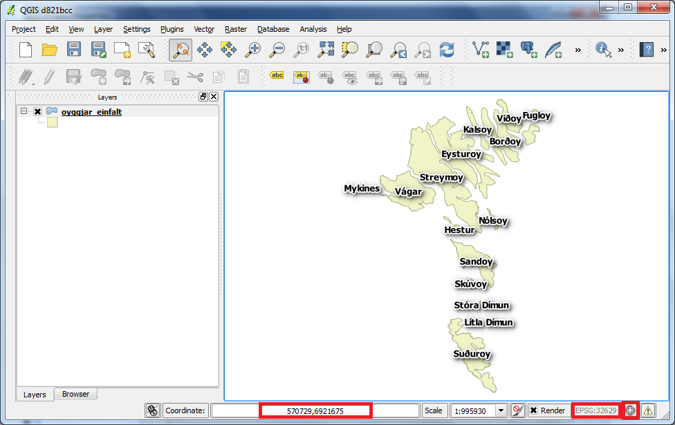
The little earth (globus) in the right bottom corner is used to switch between coordinate systems, datum and projections.
On the status bar you can also see coordinates and the EPSG code.
Click on the earth (globus).
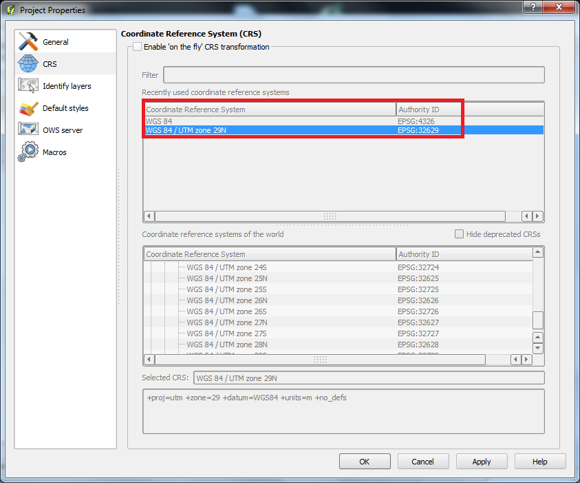
The box "Project Properties" opens and the "CRS" page is chosen by default.
You can see that the coordinate system "WGS 84 / UTM zone 29N" is chosen at the moment. The reason for this is, that the layer we work with at the moment is using this coordinate system.
Put "x" in front of "Enable on the fly CRS transformation" and you will get access to switch coordinate system.
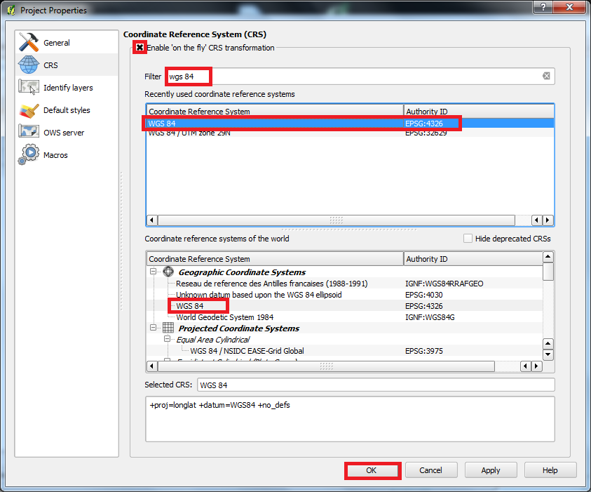
We want to switch coordinate system to "WGS 84".
Enter "WGS 84" in "Filter" and you will find all the systems, that contains this text.
Choose "WGS 84" and click "OK".
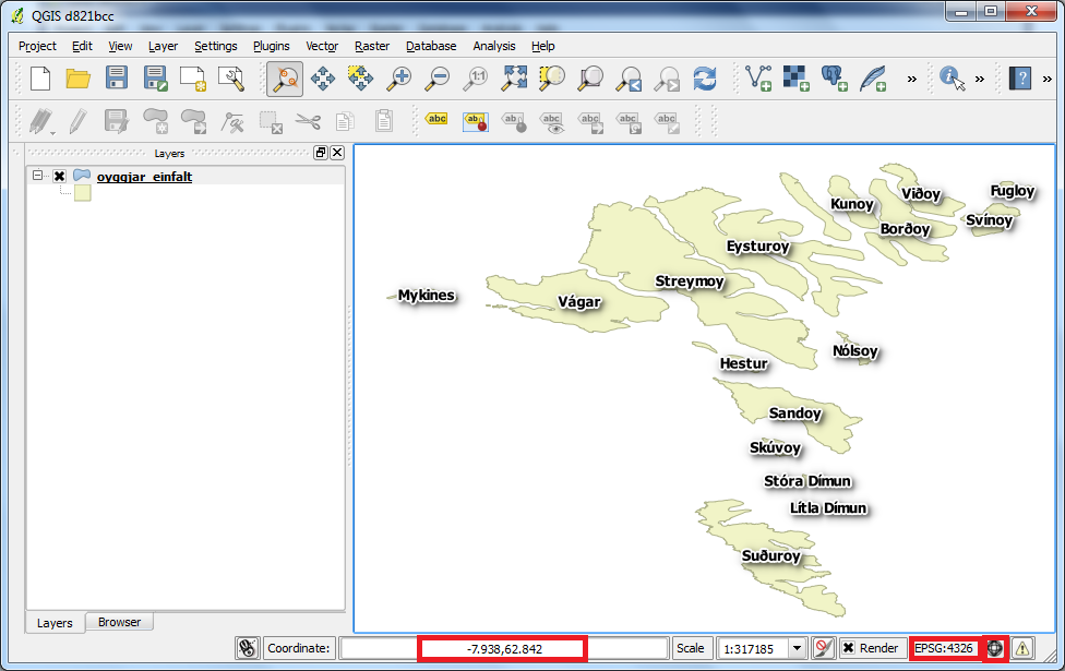
At the bottom we now see that the coordinates and EPSG code are changed. Also we see that the map is now seen from another angle than before. The reason for this is that the current coordinate system has no projection.
Click on earth (globus) again.
Now we want to switch to yet another coordinate system.
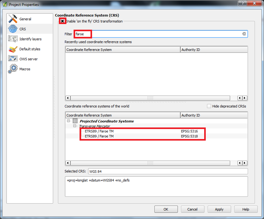
Enter "faroe" in "Filter".
We found 2 systems with the name "Faroe TM".
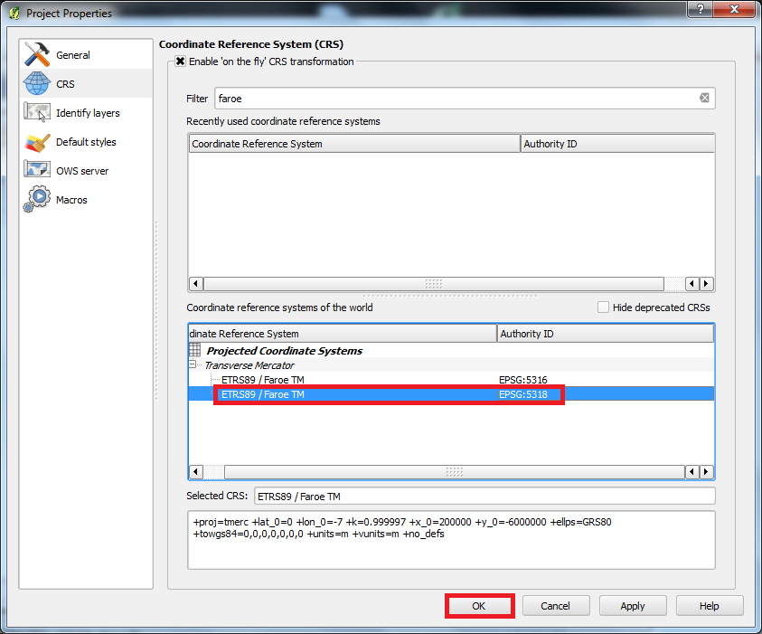
Choose the coordinate system named "ETRS89 / Faroe TM" with the EPSG code 5318. Then click "OK".
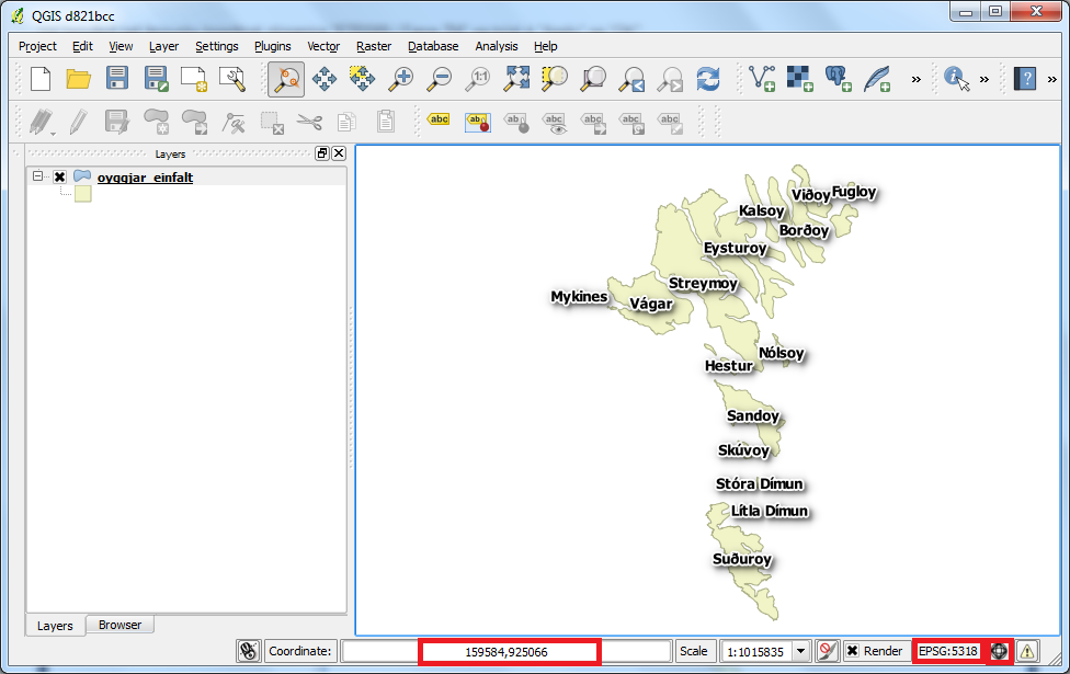
Now the islands look similar as they did in the beginning. At the other hand the coordinates and EPSG code are very different.
You are welcome to write comments below. If you have any questions, please post in the forum.